February 20, 2016
Page, Arizona
written by Angela Greynolds
This was my first ultramarathon, and it turned out to be a really great race! The scenery was beautiful and my training set me up for a strong finish.
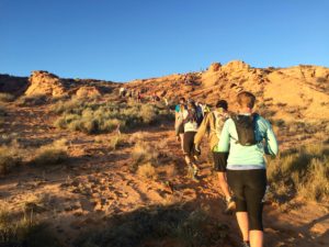 Start to Slickrock Aid (mile 2)
The race started in a fairly tight sandy area surrounded by shrubby desert right at sunrise. My plan was to start near the back of the mid-pack, but with everyone standing in a big clump and having to funnel down to almost single track right away, it was difficult to tell where we actually started. The first two miles were mostly double track, very sandy, and slow going because it was crowded.
Slickrock Aid to Horsebend Aid (mile 5)
The Slickrock Aid station marked the beginning of a plateau which we had just climbed onto. This section was still sandy with a long stretch of log-jammed single track. It wasn’t until the wide area heading down the plateau around mile four that we were able to start passing large groups of people and make some progress.
Horseshoe Bend Aid to Waterholes Aid (mile 13)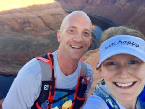
We stopped at the Horseshoe Bend Aid station to dump ur warm gear, refill a bit of water, and grab some food. It was a pretty quick in and out, and within a mile of leaving, we were at the actual Horseshoe Bend. I had never been there before but had seen lots of pictures, so of course we (and everyone else) took a lot of pictures here!
 The last couple of miles leading to the next aid station were through more deep sand and slightly up hill to boot.
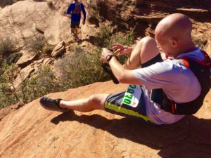
The next couple of miles were up, over, down, and around slick rock which is kind of a pain to run on mostly because the consequences for falling seem pretty dire – like falling on a human-sized cheese grater.
More beautiful views along the way though.
Waterholes Aid to Horseshoe Bend Aid (mile 18)
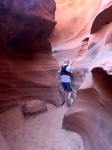 We reapplied sunscreen, picked up some more food, completely refilled our water, and were out of the Waterholes Aid Station pretty quickly. Immediately we climbed down into the Waterholes slot canyon, and it was incredible! Though we didn’t actually run through Antelope Canyon, Waterholes is longer and apparently just as beautiful. Since it was also sandy (surprise!), we spent a lot of time walking in this section and taking photos, along with everyone else.
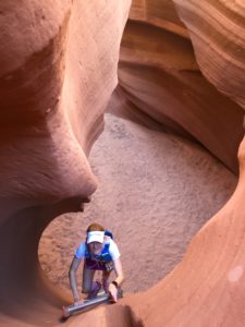 After climbing at least two ladders and weaving in and out of tight canyon walls, we found ourselves alone in a wide stretch where the canyon seemed to end and wondered for a minute if we had taken a wrong turn somehow because no on was around. Luckily we hadn’t, and we followed another pink ribbon up a steep sandy slope to climb out of the canyon and back into the sunshine.
The next couple miles were our fastest of the race, downhill on a sandy dirt power line road. It was probably the most non-stop running we did all day. Not long after we turned off the road, we were back at the Horseshoe Bend aid station after completing a 13 mile loop.
Horseshoe Bend Aid to Slickrock Aid (mile 21)
Stephen wasn’t feeling too well at this point. He had developed what we thought was a cold, but really turned out to be more along the lines of an upper respiratory infection the previous week. We ended up walking the mile or so up the sandy hill back onto the plateau rather than running, but this was probably the smart thing to do anyway since anyone that passed us running during that section got passed not too long after.
We slowly made our way back across the plateau, this time seeing hardy anyone which was way different than the traffic jam we were in going the other direction 17 miles earlier.
Slickrock Aid to Page Rim Aid (mile 23)
We stopped for a good amount of time at the Slickrock Aid station, and Stephen sat down for a while. It was mostly downhill upon leaving it, but we still walked most of it since Stephen was having trouble breathing well. We crossed over the road again right by the start area, but instead headed towards the city of Page. Before getting to the next aid station, we had to climb up onto the rim via a very steep sandy trail that felt pretty difficult at this point.
Page Rim Aid to Lake Powell Aid (mile 27.3)
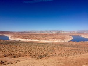 We had drop bags with shoes at the Page Rim aid station, but I chose to stick with my Hoka Challengers for the rest of the race rather than switch to the Hoka Stinsons. My feet were feeling just fine. After we left this aid station, the trail got a lot more runnable. It’s a nice single track, fairly flat, hard-packed trail that circles Page along the rim of the plateau. After spending many miles of alternating running and walking in sand, I was ready to run. Stephen was feeling worse at this point though and encouraged me to go ahead rather than wait for him each time he needed to walk. I was torn, and even though I eventually ran up ahead, I ended up waiting for him less than a mile later when I saw he wasn’t too far behind. This didn’t last long though, and I did end up running ahead for the rest of the race.
Lake Powell Aid to Page Rim Aid (mile 33.5)
I passed a few people before getting to the Lake Powell aid station which was located at the end of a short maybe quarter mile out and back. All I got was some more water here. It was starting to feel warm out. On my way back down to the rim trail, I passed Stephen heading up to the aid station.
The next 6 miles were awesome. I passed a total of 18 people after mile 26, and no one passed me. Not to say I ran the whole thing. I started to feel pretty fatigued around mile 30, but I made myself eat an extra energy bar and that seemed to help. I passed my hotel around this point too which was pretty tempting.
As I approached the Page Rim Aid station, I saw a woman who I had been reeling in for the last few miles take a left turn towards the loop we had just run rather than a right turn towards the finish line. The aid station volunteers pointed her in the wrong direction probably because they thought she had just come up the rim to start the loop. I yelled up ahead to her, “Wrong way! Wrong way!” and given that she had already started going that way, I was already on my way towards the finish line by the time she turned around.
Page Rim Aid to Finish (mile 34.2)
With only a mile to go, there were lots of people walking at this point. I was a woman on a mission though. I passed probably 6-7 people in this stretch as I flew down the steep sandy trail, leaving the plateau. After running through the dirt parking lot with a few people standing around offering words of encouragement, I entered the deep sand for the last time. The route took me up a sandy hill and back down (could we have not gone around it?) and towards what looked like a metal dock leading up to a rocky feature. More people were sitting around this area cheering runners in. Up the dock I went, around a corner, and out to the natural amphitheater with the finish line and lots of people. I was happy to finish strong and find a familiar face (Benedict Duggar) just moments after finishing.
Nutrition and Gear
For this race I carried Cliff Blocs (one of each flavor) and tried to eat an entire package every hour. I also had ProBar Fuel Bars in each flavor. I really didn’t eat much at aid stations other than some M&Ms and Coke near the end.I had 1-2 tabs of Nuun in my Osprey hydration pack the entire way. This nutrition plan seemed to work pretty well, because I obviously felt strong even in the last few miles.
I wore my North Face Better Than Naked Long Haul Skirt, a tech shirt from an old race, my Brooks visor, Zoot compression socks, and Hoka Challengers. At the start of the race, I also wore a half-zip long-sleeved running top with a hood and an Under Armour beanie, but those came off at or before the first aid station, and I left them in that dropbag.
Overall Review
This was a great first race. Although it was sandy, I think I would prefer the sand to a lot of elevation, which it didn’t have much of. Taking the first half easy allowed me to take a lot of great photos because it was the most scenic part, and it also allowed me to run hard at the end, something I enjoyed immensely. It was great to finish strong. Will I do this race again? Probably not, but I would definitely recommend it to others.
