Flagstaff has developed into a hot spot of trail running with its fairly extensive network of trails & high altitude. Among the many elite trail runners that call Flagstaff home are Chris Vargo, Alicia Shay, Rob Krar, Jim Walmsley, Ian Torrence, and Emily Harrison just to name a few. Angela and I were scheduled to head up to Seattle with my kids for a trip to visit my brothers over this weekend right before school started, but Southwest Airlines had some computer issues that prevented us from going on that trip. Instead, we figured a quick trip up to Flag would be ideal to beat the heat for a few days. So on Monday after I wrapped up some work over the weekend, we hopped in the car and drove the 4 hours or so on up to the pine covered forests.
 Angela and I as runners couldn’t be up in Flagstaff without getting out for a couple of runs, even on a family vacation. Tuesday morning I ventured out first to the Rocky Ridge trail planning a fairly quick 10 mile run that would link up with the Schultz trail, returning back to the hotel, and then allowing Angela to get out for a run through the town. Unfortunately I ran into some navigational issues and the 10 mile run turned into a 15.6 mile run. Adding to my misfortune that day, and one of the reasons for getting turned around, was that my phone died after only four miles, leaving me without anyway to look up directions, or contact Angela to let her know I wasn’t eaten by an animal. All worked out in the end but it was an adventure and Angela did still get her run in around the NAU campus and downtown on the urban trails. The rest of the day was spent having fun with the kids, including a journey to the Lava River Cave which is well worth the exploration if you’re in Flag.
Wednesday morning Angela decided to head out for her run first. Apparently she didn’t want to rely upon my sense of direction and miss her run if I got lost again. My plan was to head up, up, and up some more to the top of Humphrey’s Peak, part of the San Francisco Peaks mountain range. Humphrey’s is the highest point in Arizona, topping out at 12,633 feet of elevation. The route I planned was the most direct, starting at the Snowbowl parking lot and up the Humphrey’s Peak trail which is just under 10 miles round trip while gaining nearly 3,400 feet of elevation. I was also under some time pressure as we were supposed to be checking out of the hotel at 11am and I arrived at the Snowbowl parking lot a little after 7:00am. More importantly though is that the hotel breakfast was ending at 10am, so really I had 3 hours to get up & down, plus drive the 20 minutes back to the hotel.
 I got started right away crossing underneath the chair lift of the ski area and through it’s very green grassed field to the pine trees on the other side. Immediately the slope headed up and I quickly discovered the trail would be an interesting mix of rocks and roots. I passed a couple of hikers early on, all of us in good spirits at the start of the day. The day itself was gorgeous, clear skies and the temperatures somewhere in the low 60’s perhaps at that point. The weather actually does play a vital role when running in this area though since Humphrey’s Peak is above the tree line and extremely exposed to foul weather, notably lightning at this time of year with the monsoons. In fact, just a week prior a young 17 year old hiker was killed when he and two other friends were struck by lightning at the top of Humphrey’s.
About 3/4 of a mile up the trail I came to a registration log sign in sheet and behind it was a large sign about the forest. I skipped the registration book as I usually do and headed off to the right through the trees, soon coming to the ski run again with the chair lift looming overhead. At this point I began to wonder if I had already made a wrong turn since the grade was heading gradually downhill as I headed under the chairlift and just beyond the trail looked less than obvious. I turned around and stood there for a minute or too, hoping the hiker I’d most recently passed would appear out of the trees, confirming I was on the right path. Alas, no hiker appeared and the downward elevation of the trail seemed at odds with how much climbing should be occurring on my ascent of Humphrey’s. Two days in a row I’d made wrong turns!! Not only that, but it also ruined my Strava ascent & round trip segments by taking this detour, as I’d later find out. Getting back to the treeline I saw the sign in box again, only now noticing the path that led up and to the left. Not to mention a small directional sign pointing that direction. Doh!
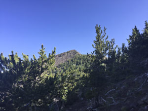
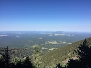
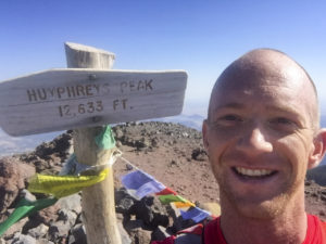
 The rest of the climb up was actually fairly runnable for the most part. I’d alternately power hiking and running these sections, passing a few groups of hikers along the way. It wasn’t until nearing about 1 – 1.5 miles from the top, nearly above the tree line, that the route became steeper. Just about 1 mile from the top you come to the saddle, where this trail intersects with the Weatherford trail, and Humphrey’s Peak trail ascends up and to the left. Here I even came back to double check the sign, again wasting some time, but at least confirming my route. This last section to the peak had a few false summits and was very rocky to the point of being not runnable because of footing. It’s actually an area of tundra and off trail hiking is not allowed. I slowed down considerably on this section with the terrain, altitude, and a bit of simply being tired. Before long though I crested the last hill and arrived at the summit to take in the absolutely gorgeous views, clocking in an ascent time of just under 1 hour & 45 minutes. Not bad considering I added four tenths of a mile and some looking around time when I got off course at the bottom. A couple of quick pictures at the top, a quick drink of water, and off I went back down…hungry for some breakfast.
The descent at first was slow going with the large boulders and overall treacherous terrain. After reaching the treeline just below the saddle the speed picked up, although still a lot of concentration was necessary as there still remained a lot of rocks and roots. I passed many of the same hikers on my descent that I had on the way up, plus a few newer groups that had headed out behind me. Overall I was enjoying the downhill but ended up rolling my left ankle over pretty good, which is unusual for me even on technical terrain. These roots are no joke. I kept on running though and didn’t feel any pain so all seemed ok. Unfortunately this happened twice more to the same ankle, the last time being followed with some pain. Ultimately I was able to keep running fine, in fact never missing stride, but the ankle would later swell up and keep me sidelined for a couple days as a precaution.
Just as I was heading out of the trees and into the fields near the chairlift I saw a runner heading my way. As he got closer my suspicions were confirmed that it was Nike Trail Elite athlete Chris Vargo. We passed going opposite directions and I casually said, “Hey Vargo” and he responded with a polite greeting too. Only about 40 yards behind him was his fiance and fellow elite runner, Alicia Shay, who also was extremely polite in saying hi. That was a pretty cool ending to my Humphrey’s Peak journey. It’s a route I definitely want to go back to again! With my detour the run came to 10.2 miles and 3,450 of elevation gain in 2:46:42. Another final piece of good news is that I made it back just in time to get some breakfast at the hotel too!
