We leave in just a few days for our grand adventure to Italy & our big race in Chamonix, France! Here are the answers to the questions we’ve been getting about this race:
What does CCC stand for?
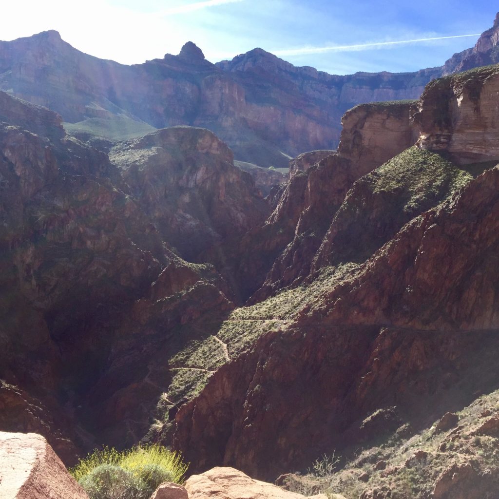
CCC stands for the three towns that the race passes through. It starts in Courmayeur, Italy, runs throw Champex, Switzerland, and finishes in Chamonix, France, all in the Alps. We will be staying in Chamonix and taking the race shuttle to the start of the race in Courmayeur the morning of the race, which goes through the 7+ mile tunnel under Mont Blanc!
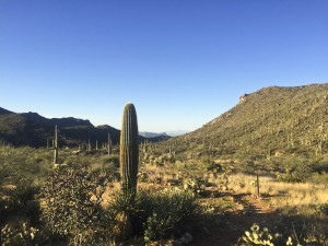
Here’s what the beginning of the race looks like:
What is UTMB?
UTMB stands for Ultra Trail Mont Blanc which calls itself the “World Summit of Trail Running.” It’s a weeklong event headquartered in Chamonix, France, featuring seven different races and culminating in the main event, the UTMB itself, which is 170km (105 miles) long. The UTMB and CCC are extremely competitive events drawing some of the best ultra runners from around the world. There are all kinds of beautiful videos about these races on YouTube that you can watch to get a better feel for it.
How long is the race?
We are running the CCC which is 101km (almost 63 miles) long. I really don’t know how long that will take me. Twenty hours on a good day? The cut-off for the race is 26.5 hours.
Have you run that far before?
I’ve done two 100Ks before, the Gorge Waterfalls in Oregon in 2017 and Black Canyon in Arizona in February of this year.
What makes this race so hard?
CCC has about 19,000 feet of elevation gain. For reference, Gorge took me 16 hours and had about 14,000 ft. of elevation gain. Black Canyon took me 14:45 and had only 7,000 ft. of elevation gain. Gorge, Black Canyon, and most other Western States Qualifiers have a 17 hour cut-off in order to get your Western States lottery ticket. You have to finish CCC in under 25 hours in order to get your Western States qualifier. That’s how much harder it is!
Have you run this race before?
Nope!
Was it hard to get into?
There was a lottery with about a 50/50 shot, but you had to qualify for the lottery in order to even enter it. The system involved adding up points from two races completed in the previous two years. We had enough points to qualify for the CCC lottery between Gorge 100K and Bryce Canyon 50 Miler, but we needed one more point to qualify for the UTMB (pretty much would have required finishing a hard 100 mile race). That’s fine with me since I’ve never run a hundred miler before and don’t want to start with that one!
The lottery system allowed you to enter as a group, so Stephen and I entered together, so that we would have both been drawn or neither been drawn. We don’t have to run it as a group though. It was just for the lottery.
How many people run the race?
Just in the CCC alone, there are 1900 runners. They come from all over the world but mainly Europe. If you order countries by how many people are participating in the UTMB event as a whole, the United States is number 9. We will be given a second race bib to wear on our backs that has our country’s flag and our first name in order to encourage interaction among runners. I speak Spanish and have been learning Italian since the day we found out we got into the race, so I’m excited to try to talk to people from those countries. Should be fun!
Do you stop to sleep or eat?
No on the sleeping. Yes on the eating. We did get a safety email from the race this week though which included a section about taking 8-20 minute naps on the side of the trail if necessary. I’m extremely unlikely to do that. There are aid stations every 5-10 miles where we can fill up water and eat snacks, just like other ultras. The one in Champex even has a hot meal. Because I’ll be reaching Champex likely after the sun goes down, I’ll probably stop for a quick dinner, but getting out of aid stations quickly is key to finishing races more quickly, so it will be a short dinner.
Will you be running at elevation?
Not really. The highest peak is just over 8,000 ft. which is lower than Mt. Lemmon here in Tucson. The rest of the race is run below that. We will pretty much be going up or down the whole time though.
What will the weather be like? (and mandatory gear)
Sometimes it rains a lot. Sometimes it’s hot. There can be blizzards on top of the peaks. Because of the volatility of the weather, we are required to carry quite a bit of mandatory gear, including things like waterproof pants, a fully waterproof jacket, a beanie, a space blanket, etc. The race organizers want us to be prepared in the event that we get injured, stop moving, and a storm rolls in. We also have to carry items like two headlamps with spare batteries for each, our own cup for aid stations, waterproof gloves, etc. A few days before the race, they can even activate one of two additional kits for either hot weather (additional water, saharan cap, sunscreen, sunglasses) or cold weather (another jacket, safety glasses). Fingers crossed they don’t activate one of those two kits! We already have enough to carry, and there are no drop bags, so we have to carry it all for the entire race!
Will you be using poles?
Europeans love their poles, but Americans not so much. I plan to bring them along, but I may not use them until later in the race, likely once it gets dark and I’m very fatigued. The second half of the race is supposed to be the most technical too, so hopefully they will help keep me upright. We ordered “Naked Bands” which go around your waist and in addition to having large pouches that will be able to carry all of our food and probably gloves, they also have two loops that allow you to fold up your poles and attach them to the small of your back (parallel to the ground). I ran my last long training run with them on like that and barely noticed they were there, so it should work out nicely. I’m really glad we discovered the Naked Band because the more gear I can get off of my back and onto my waist the better.
How did your training go?
I’ve decided to take the “arrive at the start line undertrained rather than injured” approach and do something a bit unconventional. Because I ran Black Canyon on almost zero running for the two months leading up to it due to an injury (but lots of cross training) and felt really good for the entirety of the race, I have combined that approach with a traditional approach and have been alternating running weeks with cross training weeks. I built my weekly mileage 10% per week but only every other week until I got to 60 (a new record for me). On the off weeks, I might run a short social run but focused more on strength training. This gave my body time to absorb the run training and recover, preventing injuries, while also getting stronger in order to handle all of the climbing in this race (I will NOT be running up that 19,000 feet of gain) as well as the strain of carrying all that gear on my back. We’ve done some long hard climbing days too on Mt. Wrightson, Mt. Lemmon, and Humphrey’s Peak, so climbing has been a focus.
When is the race and how can someone follow along?
Running R2R2R (Rim to Rim to Rim) is a bucket list item for most ultra trail runners, and it’s certainly one of ours. The stars have to align to make it happen though (at least for a newbie) – good weather (Spring or Fall), good training, and good health. We decided this past weekend to dip our toes so to speak into the Grand Canyon by doing a Rim to River run from the South Rim. The weather was expected to be great, our training has been pretty solid, but with a major race in two weeks, it didn’t make sense to do the entire R2R2R.
Stop in Sedona
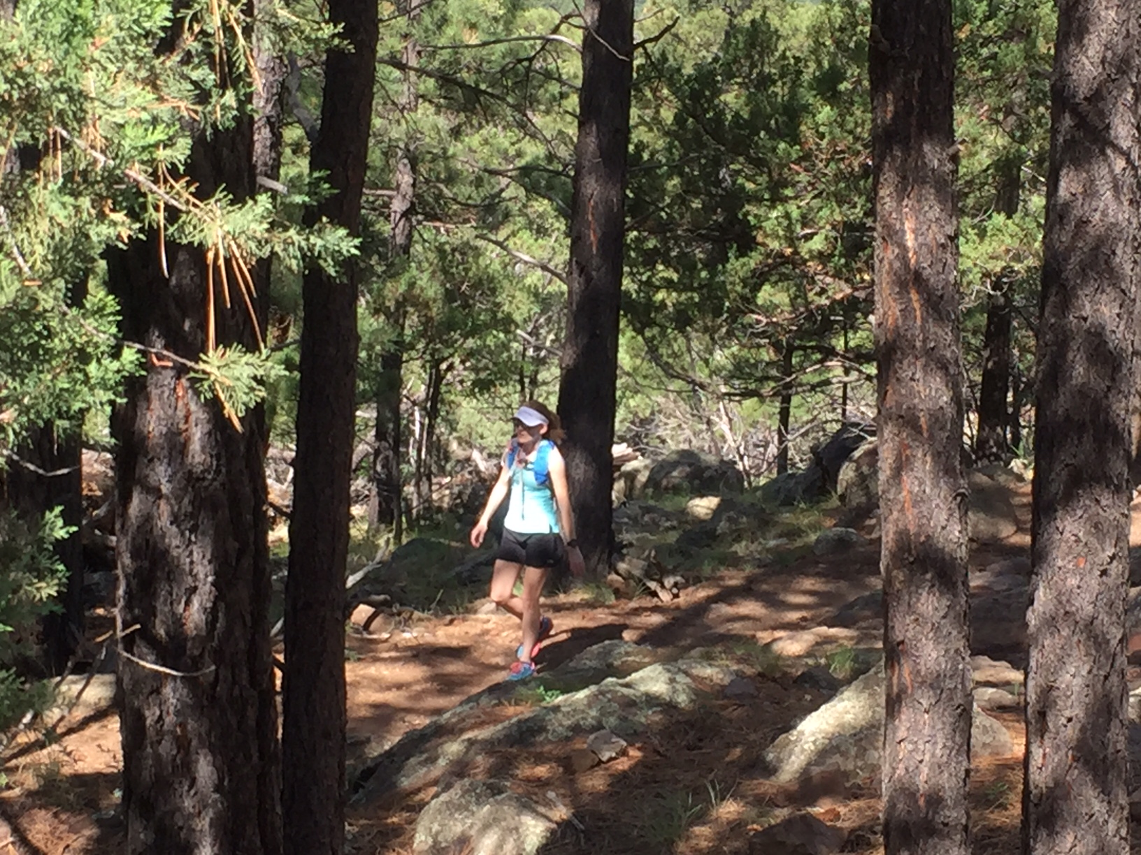
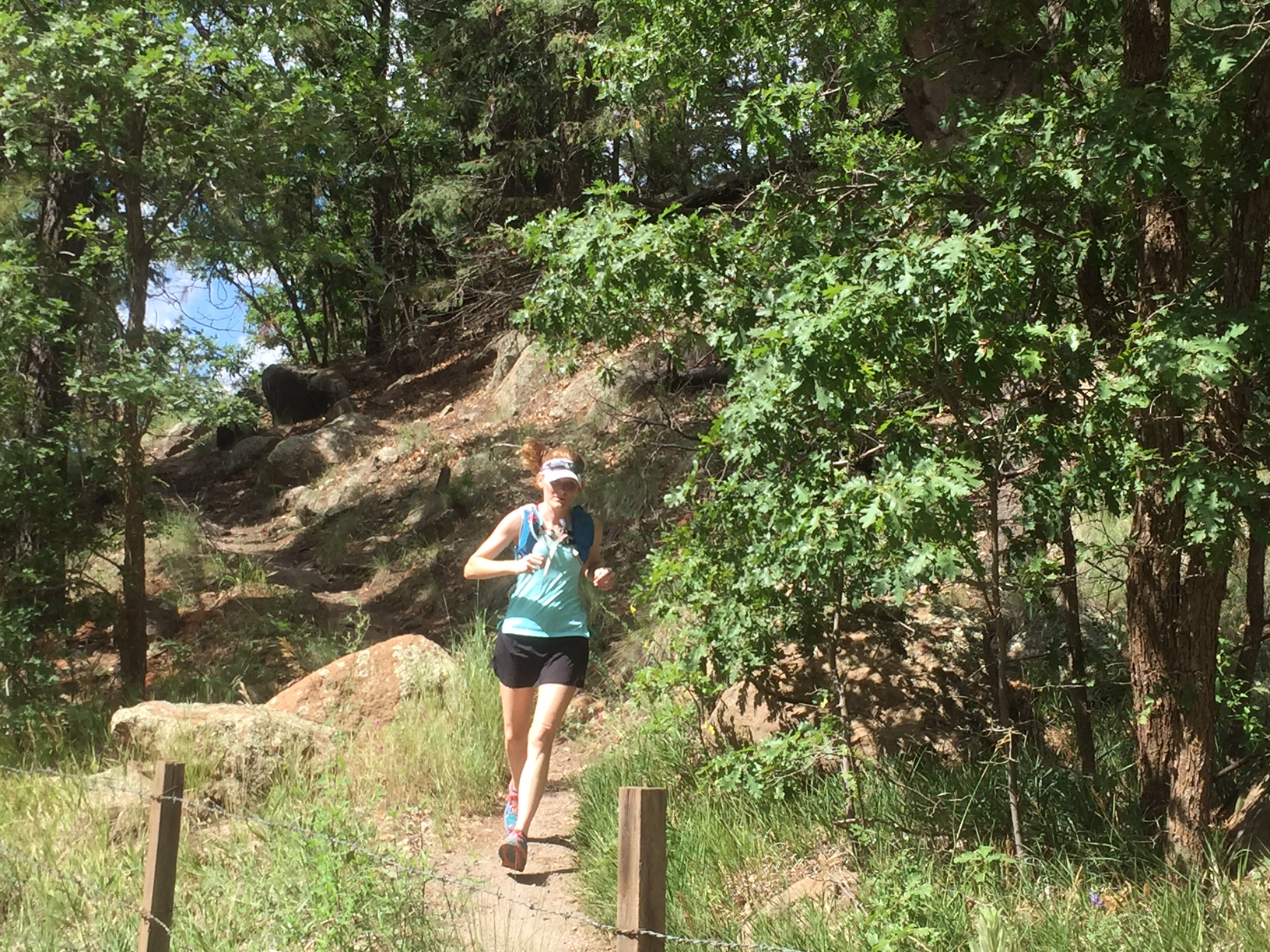
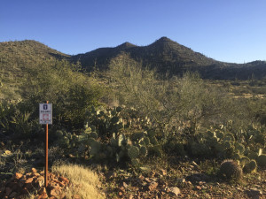
This adventure started when Stephen was invited by his Flagstaff-based coach Chris Vargo to run the Canyon. I knew there was no way I could keep up with them, so I sought out some friends from TTR to join me on a separate run. The four of us drove up to Flagstaff on Saturday morning, stopping in Sedona on the way to get in a shorter run on the Hangover Trail. This trail is popular with mountain bikers and has a curious sign that describes it as a “double black diamond” mountain bike trail. I’m not surprised. We found ourselves rock climbing up the sides of the smooth but grippy red rock multiple times as mountain bikers careened down past us. Terrifying!
Signage along the Hangover Trail in Sedona cautioning hikers and bikers that it’s EXTREME!
Injured Runner Excuse (typical)
I ran 26 miles on Saturday the weekend before as my final long training run before the upcoming 100k and then PRed the 5k distance at a race the following morning (makes sense). Ever since, my right quad has been bothering me, and my usual shin/calf issues have been pretty bad. I only ran twice during the week between this and Grand Canyon – two 3-mile runs, and both felt pretty awful. Thursday night I went to physical therapy, and she scraped the heck out of both achilles (Graston technique) leaving sore bruises behind. Needless to say, this Sedona run did not feel good. I looked like a mess too wearing a compression sleeve on my thigh, compression socks, and a brace on my left ankle since I had rolled it to the point of black and blue swelling three weeks prior and the resulting stiffness causes serious pain anytime my left foot is placed at a strange angle. The Grand Canyon run was not looking too good at this point for me.
Night Before in Flagstaff
We stayed at the historic Motel DuBeau which is located right in the heart of Flagstaff, on Beaver Street and Phoenix Ave, right next door to Macy’s European Coffee House and a block south of the train tracks. I did an exhaustive search of hotels, AirBnBs, VRBOs, independent cabin rentals, etc, and this was by far the best value for a group of four and a single night. We paid $125 total for a two-room suite. The room was clean, quieter than expected (we were in the back corner away from the street), and the bed was pretty comfortable with a memory foam mattress topper. They have a wide variety of room configurations (including hostel-style dorms), so I recommend you check it out next time you’re in Flagstaff and need a cheap, convenient, place to stay that’s not sketchy.
After checking into the motel, we walked to Pizzicleta Pizza, a block to the west, for an early 5:00 dinner. Good thing we showed up early, because they open at 5:00, and there was already a line on the street for this very small place. Had we not gotten a seat, we could have gone next door to Mother Road Brewing Company where you can also order pizzas from Pizzicleta. Stephen and I have been to Pizzicleta twice before, and it’s pretty amazing artisan pizza. He had the Margherita (mozzarella and basil), and I had the Rucola (arugula and shaved parmesan). One tasty beer each from Lumberyard Brewing, and we were good for the night. Then we all returned to the hotel for post-Sedona run showers, foam rolling, stretching, and went to bed early.
Getting to the Grand Canyon
The drive from Flagstaff is about an hour and a half to Grand Canyon Village on the South Rim. We got up at 5am and were out the door at 5:45, into the sub-30 degree temperatures. We took the 180 northwest out of town and stopped in Tusayan on the outskirts of the park to grab bananas and muffins at a gas station and then paid the $30 per car entry. Parking in Grand Canyon Village itself is sparse, so we drove all the way to the end, past the Bright Angel Trailhead, and went over the train tracks towards the parking lots away from the Canyon. Fortunately we found a parallel spot just beyond the tracks where we got ready for the run, filling bottles, putting on sunscreen, going back and forth about whether or not we wanted jackets, etc. The temperature was about 34 degrees at this point at 7:15am.
Stephen and I each took a key to the car, and Ben, Laura and I headed towards the trailhead while Stephen waited to get picked up by Chris. They were going to start later than us and at the South Kaibab Trailhead to the east. As Ben, Laura, and I approached the Canyon, we saw a train of mules headed that direction and started to get an unwanted warm-up in as we rushed to beat them to the trailhead. Luckily they were just rounding up before loading up for a trip down, so we had plenty of time to use the restrooms and get pumped up to start.
Your standard photo of the start of the Bright Angel Trail from Grand Canyon Village on the South Rim
Trailhead to 1.5 Mile Rest House
There weren’t many people on the trail at 7:30am, so the first mile and a half went pretty smoothly. We were in the shade for all of it, and it was pretty cold, but I also warmed up fairly quickly. We kept the pace slow in order not to destroy our quads. Quick stop at the 1.5 mile rest house to regroup and off we went. This is about as far as most people usually go into the Canyon. I didn’t have any pain in my calves or shins at this point, most likely due to the downhill. Hallelujah!
1.5 Mile Rest House to 3 Mile Rest House
Although the trail isn’t necessarily very technical, the large steps were a bit annoying just because their spacing did not allow for great running rhythm. I started to get pretty warm before reaching the 3 mile mark and took my lightweight jacket off at this point. I was very glad it was the only extra layer I had worn since it packs into its own pocket and weighs a matter of ounces. I’m not sure how many more times it’s going to need to happen before I finally learn the lesson that you may be very very cold before a race or a long run starts, but you WILL warm up quickly, so don’t overdress!
3 Mile Rest House to Indian Garden
This section started to “flatten” out a bit, becoming more runnable just because it wasn’t so steep. I came around a corner at one point to find Ben there “shushing” me and pointing into the bushes. There was a mule deer right by the trail, eating off of a tree, and another a few feet behind her. Ben said he came around the corner, and it was ON the trail. He almost flew right into it. They sure weren’t afraid of us, as I got quite a few pictures before they ambled away.
Mule Deer by the trail and a view of the South Rim
Ben getting close to Indian Garden on the way down
Indian Garden
The first campground that you get to is called Indian Garden, and this time of year it’s also the first place where you can get water. The two rest houses have restrooms (pit toilets), but the water is only on mid-May to mid-October. Indian Garden is beautiful because it’s found in the shade of tall light green Cottonwood trees, but it was particularly beautiful today due to numerous purple trees that looked like cherry blossoms. We stopped to top off our water and use the restroom before continuing on. The trail heading out of Indian Garden was under construction, so we had to take a well-marked detour down the trail towards Plateau Point for about a hundred yards before getting back onto the Bright Angel Trail.
The campsite at Indian Garden that my friends and I stayed at in 2014 when we hiked rim to rim
Indian Garden to the River
The section after Indian Garden is pretty neat. You run along a small creek for a lot of it, and you also run under a bit of an overhanging cliff. It’s also a lot more runnable than anything to this point. Eventually, you come out into an expansive section overlooking “The Corkscrew” which is a series of steep switchbacks leading quickly down into the canyon. After completing the switchbacks, you cross over multiple small streams, all of which could be done without getting our feet wet with some creative rock hopping. About this point, we ran into Stephen and Chris coming up after having come down the South Kaibab Trail. We stopped and chatted for a bit and then continued on towards the river while they continued to climb out.
Laura coming down the Bright Angel Trail after Indian Garden
Those switchbacks down below are part of “The Corkscrew.”
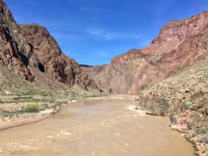
The Colorado River
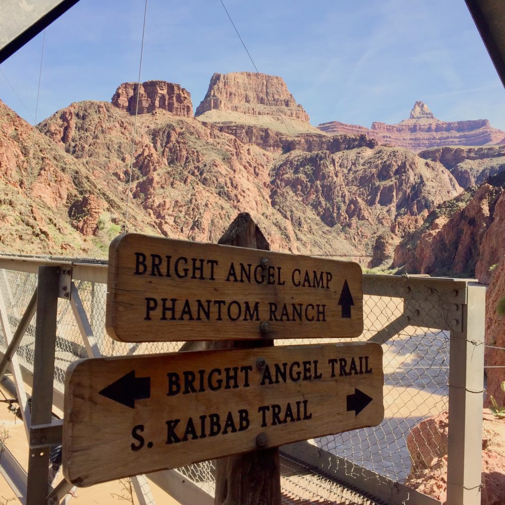
As you approach the river, there’s a small spur trail on the left leading to a small beach, which we didn’t go to, and there’s also a restroom with pit toilets. Just beyond the restroom you start climbing a tiny bit as you run along the side of the cliff overlooking the muddy Colorado river. This section also has some extremely sandy sections. Eventually you get to the silver bridge which takes you across the river and then take a right towards Phantom Ranch.
Signage is ample throughout
Phantom Ranch
Bright Angel Campground is the second campground headed this direction, and it is located along a stream less than a quarter mile before reaching Phantom Ranch. There is a REAL bathroom here, complete with functioning toilets and even an outlet. We stopped at the Canteen at Phantom Ranch, and I bought a lemonade and a 4-pack of Oreos for a total of $4. It’s not overpriced! They have all kinds of goodies – pretzels, candy bars, Clif bars, Shot Blocs, soda, etc, things hikers/runners might need – bandaids, chapstick, magical cooling towels, and you can even send a postcard that will be carried out by mules. Make sure you bring money and addresses!
After snacking while Laura wrote her postcards, I went back outside, and I found that I actually felt cold again. Running in the sun, I had been wishing I hadn’t worn long pants, but now that my body had cooled down, I realized it certainly wasn’t hot outside. We talked to a few hikers hanging out at the picnic tables outside under the trees, and then started our return trip.
The Phantom Ranch Canteen which acts as an aid station
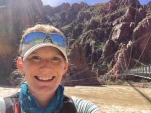
Looking back towards the river and the South Rim from Phantom Ranch
Quick “Mission” to Accomplish
For the background behind this mission, see below:
After numerous guesses from me and a ton of other people, no one got the correct answer. Then Bob gave the clue “you can hear water running,” and I immediately knew that it was the bathrooms near Phantom Ranch because of the stream right by the campground. I hiked from the North Rim to the South Rim with a group of friends over 4 days and 3 nights a few years ago, and we stayed at each of the three campgrounds in the Canyon including this one.
When I saw Bob in person last month, he told me there is no “Phantom Ranch Campground.” I looked it up and sure enough, it’s called the “Bright Angel Campground” (should have known that), so I knew on this trip that I would need to recreate this photo. After leaving Phantom Ranch, we made a slight detour to the end of the campground to get this photo…
Anyway, I didn’t win, but it was fun 🙂
Out of the Canyon
Coming out of the Canyon is as to be expected: pretty hard. My calves greatly appreciated the long downhill warm up though, and I found the climb out not to be too terrible, thanks to recent TTR runs which I would say are harder (Esperero Loop comes to mind). I refined my power hiking a bit, taking quicker shorter steps that placed less strain on my calves, and I felt that I moved a bit faster this way too. Although I didn’t feel like a trail “runner” anymore, we still were passing hikers left and right. About a half mile from the top, while zig zagging through weary casual hikers in their jeans and sandals and carrying plastic water bottles, my watch died as it tried to muster the strength to give the 21 mile beep, ugh, so I missed some important Strava segments (booo!), but I really didn’t care because the experience was so awesome, and I did it all, regardless of what Strava says 🙂 Next time, Rim to Rim to Rim!
Finishing up the Corkscrew. Although AZ is in full bloom, these were some of the only yellow flowers I saw.
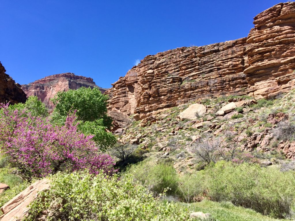
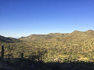
The master planned community of Dove Mountain sits right at the base of the Tortolitas and thankfully is pretty close to our home. Because of that it’s a location that’s convenient to run at, although some of the trails feature some fairly rugged terrain with large boulders. Previously I had explored all of the different trails other than Cochie Springs Trail. Today I decided to go check out this trail that sits farthest to the west, in a separate canyon from all the other trails. This particular trail also is an out & back so had never looked quite as appealing before. My opinion of its appeal certainly changed though.
Like all these trails near the Ritz Carlton you start off at the Wild Burro Trailhead, just before the Ritz itself. Initially you head north up the Wild Burro trail which weaves back and forth over a wash while gradually ascending. About 3/4 of a mile in you come to the first major junction where the trails begin to split off. Turning to the left heading west quickly brings you across the wash again and to another junction, with the Burro heading north and the Upper Javelina continuing up the hill to the west and providing access to both the Wild Mustang and Cochie Springs trails. It’s worth noting that each of these trails is color coded as well making identification of them while running much easier. Upper Javelina is fairly short but pretty steep and very rocky, with many large boulders that just aren’t as much fun to navigate. Thankfully it is a short trail and once you get on top of the hillside, above the Ritz, you start on the Wild Mustang trail briefly before the trail for Cochie Springs breaks off, heading south for a bit before bending to the west across to the other side of the hill and the aptly named Cochie Canyon. It’s on this section of trail that you have a really neat view of the golf courses below in the distance and distant Tucson Mountain views.
Once on the Cochie Canyon trail (and actually beforehand on Wild Mustang) the terrain becomes much more runnable. It’s definitely fairly rocky footing, but smaller rocks that are more easily managed, not too dissimilar to the Phoneline Trail in Sabino Canyon. Also like the Phoneline Trail is that the Cochie Spring Trail runs for a couple of miles about midway up against the mountain side. Because this is the most remote trail it certainly appeared it wasn’t heavily trafficked. There was some overgrowth but most of the grass alongside the trail appeared to have been fairly recently cut. While there are some sections that are flatter, the trail mostly features some rolling uphill and downhill. There are some areas of larger boulders that again are slightly more difficult to manage and a couple of steeper sections, but they’re few and far between. Eventually the trail descends down off the hillside and into the wash of the canyon with a sign right beforehand telling you that you’re now 5 miles from the trailhead. Once to the wash you’ll see an old cattle station and windmill. The trail was much more overgrown through this area and the path became less obvious but simply stay on the same, east side of the wash. There are some cairns if you look closely enough too. I went just a little bit further up the trail here since my training plan only called for 10 miles this day. Based on the map the trail does continue on for almost another mile though and I believe with a little bushwhacking you can actually connect to jeep roads that lead all the way around the other side of the Tortlitas.
My impressions of the trail were very favorable overall and the rolling terrain provided a good solid workout. The 10.5 miles I covered showed a total elevation gain of between 1,667 feet (Strava) to 2,303 feet (Garmin). As with most rolling trails the elevation gain can vary quite a bit. Based on my feel of the run I’d say the elevation gain was probably somewhere smack dab in the middle at about 2,000 feet or just under. I’ll certainly be returning to this trail, especially in the winter months when the slight overgrowth provides a bit less concern for snakes.
Having been introduced to trail running much later in my life and finding such happiness in the endeavor & the community alike, I wanted to make sure my kids got exposure to it much sooner. We had gone out for a few hikes in the past and my daughter, Tenli, ran her first 5k on her 8th birthday at the Marana 5000 this past March, but we really hadn’t yet ventured too much onto the trails. On one of our more recent hikes up towards Romero Pools both of my kids did in fact run a little bit of the singletrack section. Just seeing their natural desire to run the rocky trail was really cool.
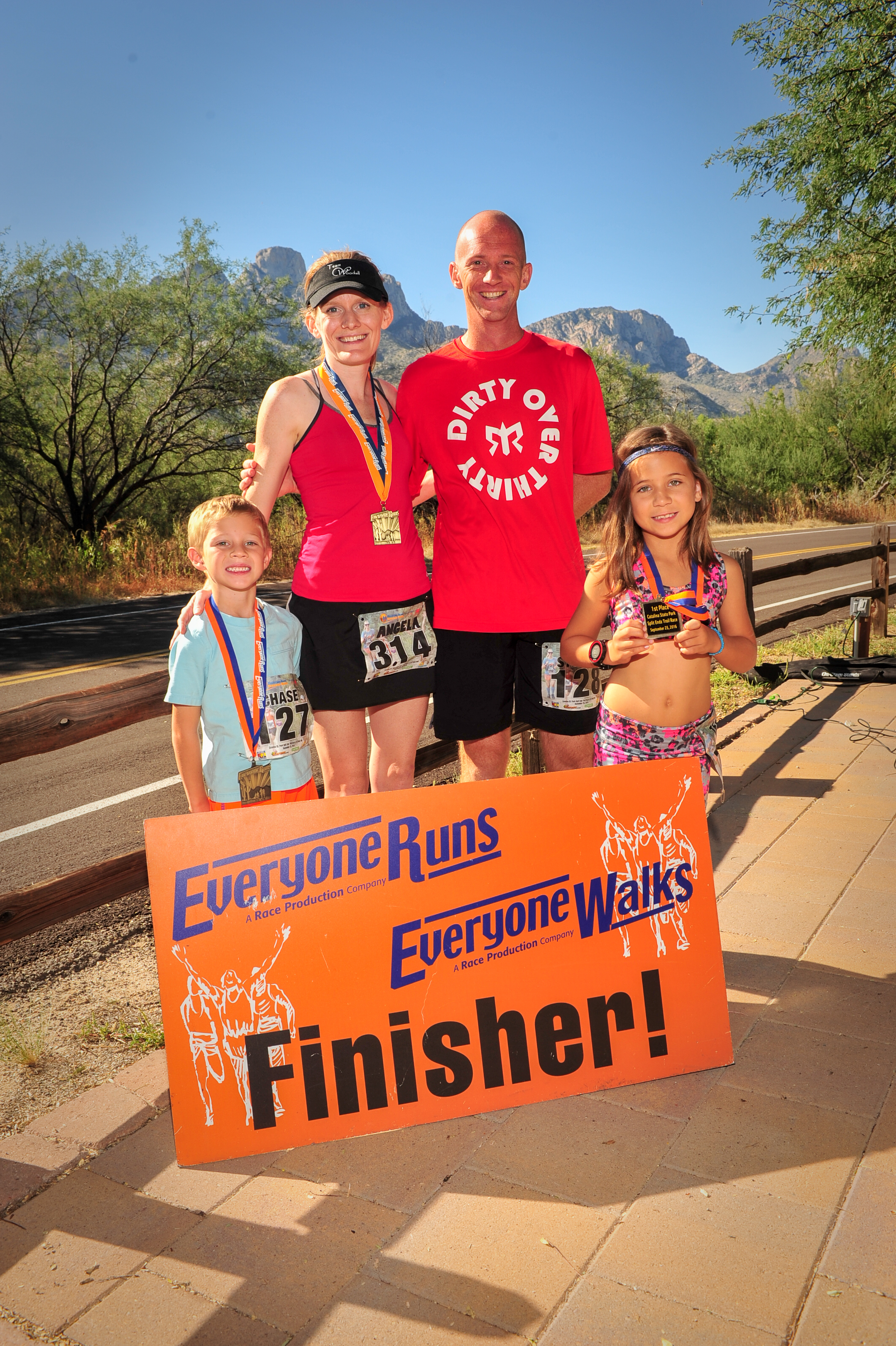
After her successful first race Tenli wanted to do another race and my son, Chase, also wanted to give it a try this time. He’s about 2 1/2 years younger and just turned 6 in late August. Since they both wanted to do a race I suggested one option might be the Everyone Runs Split Endz 5.2 mile trail race at Catalina State Park on September 25th. The timing worked well in that they both had enough time to get a little bit of modest training in beforehand and Catalina State Park is very close to our house in Oro Valley. Knowing about my adventures on the trail they both eagerly agreed that would be a fun race, so we signed them up! Angela decided fairly late to do the 10.3 mile race although she’d be coming off a long 22 mile training run the day prior.
Like father like son!
Armed with a race date on the calendar they began their training, albeit begrudgingly on some days, and before long the race day was upon us. We’d run the course in pieces during the training and I’d made sure to point out any turns & junctions as we went along but we’d never run the entire thing as a whole. The plan was that I’d run with Chase since it was his first race and Tenli would run it on her own this time after having had me pace her during the 5k. She really sandbags it in training while Chase often runs pretty strong, so I wasn’t sure if she’d be running in front of us or behind us honestly. Pacing for this race was difficult because the longest run they’d done continuously was a bit over 4 miles and we didn’t run too often on the trails during training simply due to time constraints/darkness. The race starts on the Birding Loop for 1 mile before transitioning to the Canyon Loop for about 3 miles, and then finishes on the Nature Loop for about a mile. There are a few steep, short hills, some gradual inclines, and a variety of footing but mostly it’s fairly sandy.
All of this led to us starting towards the back of the pack, which in a singletrack trail race like this means a conga line formed quickly in front of us. On the Birding Loop we actually came to a full stop a couple of times. This didn’t bother me as I wanted them to go out patiently and not blow up early. Chase though wasn’t used to having to wait behind people and started going around them on the side/off trail. He was so small that it actually was fairly easy for him but I had to reign him in a bit. That first mile was pretty slow at 14:25 (GPS watch shows 13:16 moving time – yeah, it got backed up) but that was totally fine with me. Tenli was just in front of us after that first mile but she started then picking up her pace when the course opened up to doubletrack. We powerhiked most of the hill that begins the Canyon Loop when you head counterclockwise and before long Tenli was out of sight. I only hoped she would pace herself enough so she had a pleasant experience.
Tenli cruising along to her age group win.
Chase meanwhile kept chugging along as we passed more and more people who had started out too fast. Our second mile split was 12:11 and the third was 11:56. He seemed to be running very comfortably but his little legs still had a long way to go. We had passed Tenli as she went the other direction on a short out & back section around the 2 mile mark and she looked great. People were commenting constantly all day long about how impressed they were with both Tenli & Chase. It was certainly a proud dad moment hearing all those great compliments. About this time we saw Manny Ochoa, a fellow TTR runner, come by us on his second loop of the 10.3 mile race that started a little earlier, holding a pretty sizable lead.
Chase kept up his consistent effort through the remainder of the Canyon Loop, logging a 12:12 4th mile before hitting the last steep hill of the day up the beginning of the Nature Loop. We again powerhiked most of this section as I didn’t want him wearing down trying to run something too steep. That last loop of singletrack I was telling him to finally let go a bit and push the pace as much as he wanted. He appeared to finally be struggling a bit, although he kept saying he felt good. This 5th mile he completed in 12:23 before running back down that steep hill and along the main road towards the finish line. He definitely had a really solid sprint left in his legs that last almost three tenths of a mile. I had to really extend my stride to keep up as we crossed the finish line moving at a sub 7:00/mile pace.
A great day for everyone!
Tenli was waiting for us at the finish line, having finished the race with a chip time of 59:48 in 94th place out of 194 finishers. Officially that translates to a 11:30/mile pace which was really good considering how slow the first mile turned out to be. She was picking people off all race long which is always a great feeling for a runner. Chase and I ended up with a chip time of 1:05:38 and in 127th & 128th place out of those same 194 finishers. That also is super impressive to me for his first official race. By no means is this a super easy course with the sandy conditions and there is a total of about 380 feet of elevation gain throughout so it’s also not flat like many road races. I really couldn’t be any prouder of their accomplishments. Just to see them both give their best efforts and enjoy the day was great. The fact that they both won their age groups (Chase was 1 of 1 and Tenli was 1 of 2) and received medals was probably more satisfying to them of course. Their determination to run the entire thing (except the hills I told them to walk) really showed their grit. Passing full grown adults also gave them motivation and I hope some of the lessons they’ve learned carry over into other aspects of their lives.
Overall it was a great day! Angela ended up finishing 3rd in her age group with a huge race PR even after the long effort the day before & a nagging injury. My dad had jumped into the race fairly late as well and finished 3rd in his age group (although behind Tenli). Plus some friends of ours also finished extremely well. Manny ended up winning the 10.3 mile race and our good friend Julio Garcia placed 2nd overall in the 5.2 miler.
Chase has since been wearing his overly large race finisher’s shirt at every opportunity he gets. I look forward to the next time they want to tackle another race! For some reason Chase is insistent on wanting to do a 7 mile race. Not sure why he picked that odd distance but maybe the Sabino Sunset run is in his future.
That would likely have been my response if someone suggested I spend money on hiring a coach for my running. In the last two years since I started running, and primarily in the last year plus that I began to enjoy trail running and exploring ultras, it has been a journey to learn all that I can about the sport. This has run the gamut from training plans, shoes, running form, nutrition, and so on. I’ve enjoyed looking online at various sites, listening to hours and hours of podcasts, trying to gleam nuggets of wisdom from seasoned ultrarunners, elites, and coaches. With so many resources out there I wouldn’t have thought there was much necessity for having a coach for a recreational runner like me.
However, it’s something that I’ve been contemplating over the last few months as I made the decision to sign up for the Javelina Jundred. Heck I thought, even elite runners often utilize coaches to guide them and provide that independent assessment of their training & analyze their performance. I’m clearly not an elite runner I would tell myself, so why would hiring a coach be for me? Well, I finally determined that the reason I wanted a coach was to make the most out of my own running, even though it will only ever be a recreational activity. After suffering a couple of knee issues/injuries that have sidelined me from running, I quickly learned the importance of having excellent support in maintaining my body with physical therapy. Continuing to develop a network of professional advice could not only improve my performance but also make me less prone to injury.
Which coach to hire? That was the next question to tackle after making the decision to move forward. I definitely knew having someone experienced with ultras would be key since that’s what I’ve found myself attracted to now. Ultimately having someone who was available to answer my questions as they arose and who I felt I could communicate well with would be the best fit. After visiting Flagstaff last month and running right by Chris Vargo, an elite ultrarunner living in Falg, I figured he’d be someone that I should reach out to. Having heard him on several podcasts I enjoyed how he was laid back in his manner, seemed approachable (this was confirmed when he responded to my comment on his Strava run that day we crossed paths), and certainly was well versed in ultrarunning.
After making contact and finding out a bit more about his services I pulled the trigger and signed up on a monthly basis. It’s only been a few weeks since he’s begun coaching me but already I feel like I’m learning how to better prepare myself for races. None of the training runs he’s prescribed for me are things I didn’t know about. However, the workouts are something I wouldn’t schedule for myself and certainly not with any larger scale picture in mind of when to perform them during a week, how many days of the week, etc. Paying a coach like Chris also allows me to not worry about the training component as much and focus on my execution. I’ve begun to look at my runs as training sessions where an easy run should be easy, not a mid-paced effort that’s neither easy nor a workout. Running easy is something I still probably need to improve on but it’s at least something I’m acutely aware of now.
With Javelina being my first 100 miler there’s little statistical basis for comparison to see how I might have improved with a coach. However, I already feel like it’s been worthwhile and look forward to continuing to explore my own personal limits and goals with some help. Perhaps having my coach step in as a pacer for Javelina Jundred will be possible and would be a real asset to my completion of that race. To be continued…
More Flagstaff adventures! Even though we had just visited the area with the kids, Angela and I decided to head back up to Flagstaff this weekend as one last quick trip out of town before she would be back to her teaching. The cooler weather was a major draw of course and the vibe of Flag also is relaxing and welcoming. Not to mention we were again looking forward to sampling some pizza from Pizzicleta.
Arriving on Friday afternoon Angela took the day off from running while I got in a quick 7 mile easy run right from the hotel onto the Flagstaff Urban Trail system. It’s really excellent that the city dedicates the resources to developing such a great system of mixed use trails around town. This run had some strides thrown into the mix towards the end which I really think will benefit my speed moving forward. The next day was set to be a long run for both of us. Angela planned to do around 14 while I hoped to get in 18 miles in my build towards Javelina Jundred. We discussed a few trail options and ultimately decided on the same Rocky Ridge to Schultz Creek trail loop that I inadvertently took the weekend prior.
One of the major benefits of running in Flagstaff was NOT having to get up super early to beat the heat. We had a lazy morning around the hotel, eating breakfast first before heading up to the trailhead. The route would start on the Rocky Ridge trail, to Lower & then Upper Brookbank, catch Sunset, before descending down Schultz Creek. Total mileage for this route came out to 13.4 with 1,885 feet of elevation gain. Most of this gain comes in the early part of the run up Rocky Ridge and particularly the Brookbank trails. Angela and I stayed together for the first 5 miles as I wanted to get through most of the major intersections before we separated. Since I had gotten a bit turned around last time I knew the major problem areas of the route. The plan was I would run ahead after that to get my extra miles so she wouldn’t have to wait around for me too much at the end.
Once I went off ahead the running picked up as we had reached the more runnable sections of the trails anyway. Being that it was a very pleasant Saturday there were many other hikers, bikers, and a few trail runners out as well. One interesting encounter was with a hiker who had her dog alongside her. As I approached from behind and called out to her to make my presence known she nicely held the dog as I went by. However, she must not have held on quite long enough as soon the dog came up behind me and I had a new running companion. Or at least that’s what it seemed like at first as the dog and I switched places leading for fifty yards are so. Then, unexpectedly the dog came alongside me and I felt the pressure of its teeth on my leg. While it may have been a “playful” interaction I reacted automatically by yelling at the dog and thankfully it quickly backed off, as the owner called out to it as well. I’m normally not too skittish of dogs but really even out in the wilderness they should be on leashes if not EXTREMELY mild mannered.
The rest of the run went well enough, descending down Schultz Creek faster than I had even the week prior. Since I had another 4.5 miles to complete at the end I went out into the nearby neighborhoods for a stretch and then back up the Schultz Creek trail, figuring I’d pass Angela going the other way at some point. The weather had begun to turn a bit and right as I came upon Angela the rain started as thunderstorms built in the area. Quickly I found myself in a downpour and lightning was visible fairly close nearby. That’s all I needed to see and I turned around about a quarter mile short of where I needed to get the full distance. This would put me only at 17.5 miles total for the run, but it’s just not worth any risk for a measly half mile. Especially when our plans the next day were to go back up Humphrey’s Peak which would put me over mileage for that day’s planned run.
Another great time up in Flagstaff and we hope to get back up there again soon and explore some different trails. Kendrick and Elden are two more peaks that will probably have to be conquered on the next trip!
Flagstaff has developed into a hot spot of trail running with its fairly extensive network of trails & high altitude. Among the many elite trail runners that call Flagstaff home are Chris Vargo, Alicia Shay, Rob Krar, Jim Walmsley, Ian Torrence, and Emily Harrison just to name a few. Angela and I were scheduled to head up to Seattle with my kids for a trip to visit my brothers over this weekend right before school started, but Southwest Airlines had some computer issues that prevented us from going on that trip. Instead, we figured a quick trip up to Flag would be ideal to beat the heat for a few days. So on Monday after I wrapped up some work over the weekend, we hopped in the car and drove the 4 hours or so on up to the pine covered forests.
Angela and I as runners couldn’t be up in Flagstaff without getting out for a couple of runs, even on a family vacation. Tuesday morning I ventured out first to the Rocky Ridge trail planning a fairly quick 10 mile run that would link up with the Schultz trail, returning back to the hotel, and then allowing Angela to get out for a run through the town. Unfortunately I ran into some navigational issues and the 10 mile run turned into a 15.6 mile run. Adding to my misfortune that day, and one of the reasons for getting turned around, was that my phone died after only four miles, leaving me without anyway to look up directions, or contact Angela to let her know I wasn’t eaten by an animal. All worked out in the end but it was an adventure and Angela did still get her run in around the NAU campus and downtown on the urban trails. The rest of the day was spent having fun with the kids, including a journey to the Lava River Cave which is well worth the exploration if you’re in Flag.
Wednesday morning Angela decided to head out for her run first. Apparently she didn’t want to rely upon my sense of direction and miss her run if I got lost again. My plan was to head up, up, and up some more to the top of Humphrey’s Peak, part of the San Francisco Peaks mountain range. Humphrey’s is the highest point in Arizona, topping out at 12,633 feet of elevation. The route I planned was the most direct, starting at the Snowbowl parking lot and up the Humphrey’s Peak trail which is just under 10 miles round trip while gaining nearly 3,400 feet of elevation. I was also under some time pressure as we were supposed to be checking out of the hotel at 11am and I arrived at the Snowbowl parking lot a little after 7:00am. More importantly though is that the hotel breakfast was ending at 10am, so really I had 3 hours to get up & down, plus drive the 20 minutes back to the hotel.
I got started right away crossing underneath the chair lift of the ski area and through it’s very green grassed field to the pine trees on the other side. Immediately the slope headed up and I quickly discovered the trail would be an interesting mix of rocks and roots. I passed a couple of hikers early on, all of us in good spirits at the start of the day. The day itself was gorgeous, clear skies and the temperatures somewhere in the low 60’s perhaps at that point. The weather actually does play a vital role when running in this area though since Humphrey’s Peak is above the tree line and extremely exposed to foul weather, notably lightning at this time of year with the monsoons. In fact, just a week prior a young 17 year old hiker was killed when he and two other friends were struck by lightning at the top of Humphrey’s.
About 3/4 of a mile up the trail I came to a registration log sign in sheet and behind it was a large sign about the forest. I skipped the registration book as I usually do and headed off to the right through the trees, soon coming to the ski run again with the chair lift looming overhead. At this point I began to wonder if I had already made a wrong turn since the grade was heading gradually downhill as I headed under the chairlift and just beyond the trail looked less than obvious. I turned around and stood there for a minute or too, hoping the hiker I’d most recently passed would appear out of the trees, confirming I was on the right path. Alas, no hiker appeared and the downward elevation of the trail seemed at odds with how much climbing should be occurring on my ascent of Humphrey’s. Two days in a row I’d made wrong turns!! Not only that, but it also ruined my Strava ascent & round trip segments by taking this detour, as I’d later find out. Getting back to the treeline I saw the sign in box again, only now noticing the path that led up and to the left. Not to mention a small directional sign pointing that direction. Doh!
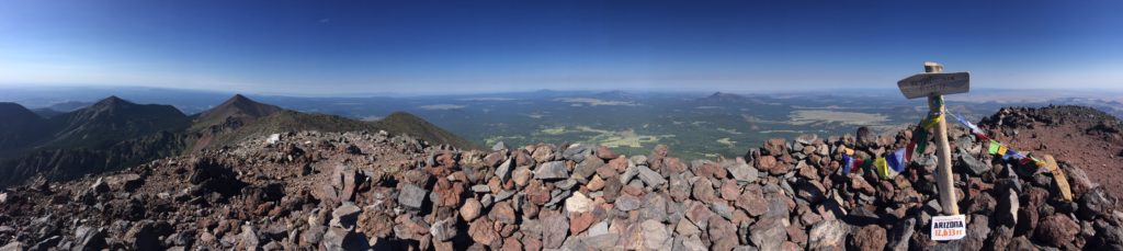
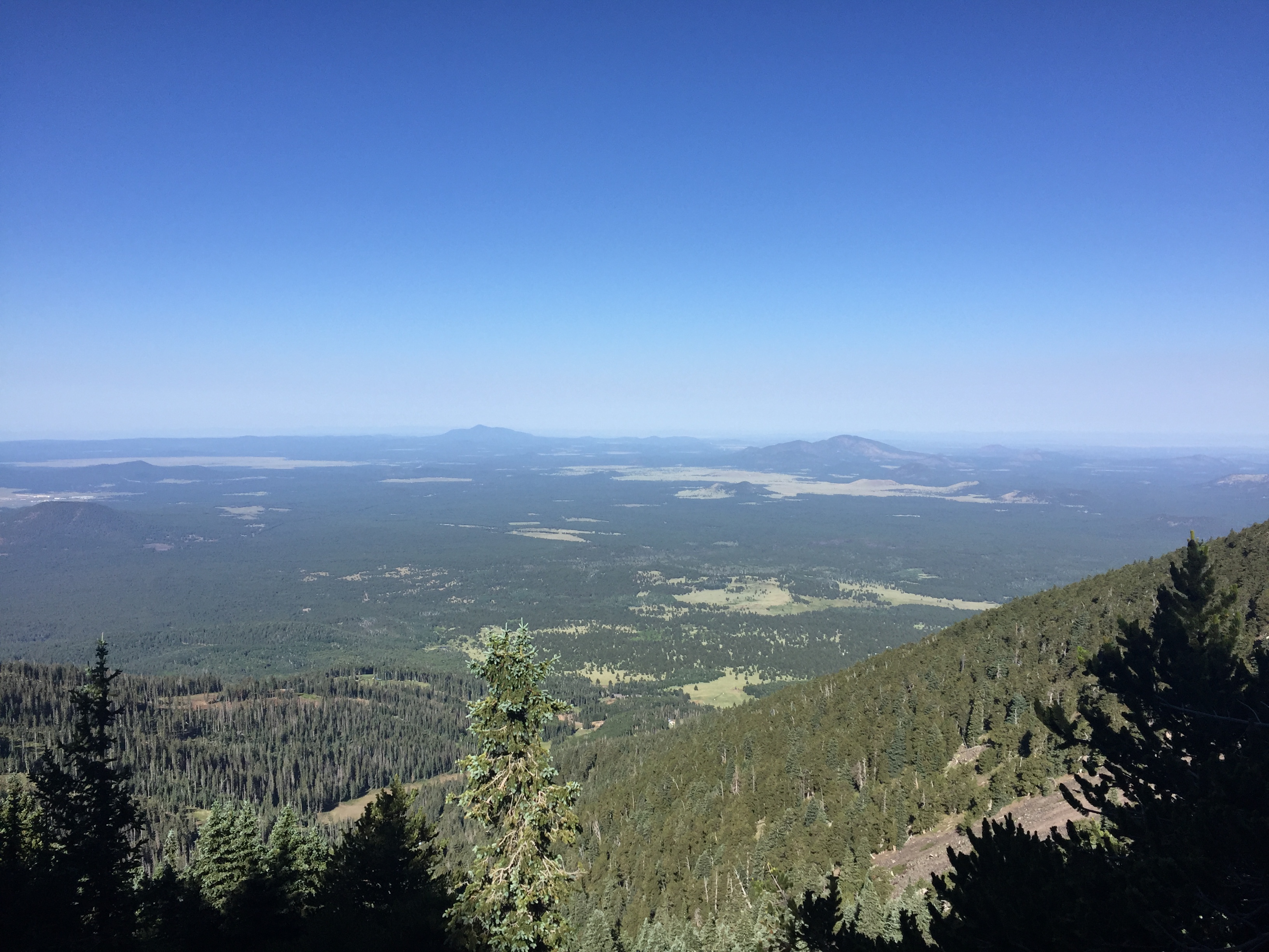
The rest of the climb up was actually fairly runnable for the most part. I’d alternately power hiking and running these sections, passing a few groups of hikers along the way. It wasn’t until nearing about 1 – 1.5 miles from the top, nearly above the tree line, that the route became steeper. Just about 1 mile from the top you come to the saddle, where this trail intersects with the Weatherford trail, and Humphrey’s Peak trail ascends up and to the left. Here I even came back to double check the sign, again wasting some time, but at least confirming my route. This last section to the peak had a few false summits and was very rocky to the point of being not runnable because of footing. It’s actually an area of tundra and off trail hiking is not allowed. I slowed down considerably on this section with the terrain, altitude, and a bit of simply being tired. Before long though I crested the last hill and arrived at the summit to take in the absolutely gorgeous views, clocking in an ascent time of just under 1 hour & 45 minutes. Not bad considering I added four tenths of a mile and some looking around time when I got off course at the bottom. A couple of quick pictures at the top, a quick drink of water, and off I went back down…hungry for some breakfast.
The descent at first was slow going with the large boulders and overall treacherous terrain. After reaching the treeline just below the saddle the speed picked up, although still a lot of concentration was necessary as there still remained a lot of rocks and roots. I passed many of the same hikers on my descent that I had on the way up, plus a few newer groups that had headed out behind me. Overall I was enjoying the downhill but ended up rolling my left ankle over pretty good, which is unusual for me even on technical terrain. These roots are no joke. I kept on running though and didn’t feel any pain so all seemed ok. Unfortunately this happened twice more to the same ankle, the last time being followed with some pain. Ultimately I was able to keep running fine, in fact never missing stride, but the ankle would later swell up and keep me sidelined for a couple days as a precaution.
Just as I was heading out of the trees and into the fields near the chairlift I saw a runner heading my way. As he got closer my suspicions were confirmed that it was Nike Trail Elite athlete Chris Vargo. We passed going opposite directions and I casually said, “Hey Vargo” and he responded with a polite greeting too. Only about 40 yards behind him was his fiance and fellow elite runner, Alicia Shay, who also was extremely polite in saying hi. That was a pretty cool ending to my Humphrey’s Peak journey. It’s a route I definitely want to go back to again! With my detour the run came to 10.2 miles and 3,450 of elevation gain in 2:46:42. Another final piece of good news is that I made it back just in time to get some breakfast at the hotel too!
The Antelope Canyon 55k is in exactly one week from today and it’s only three weeks until the Old Pueblo 50. After last weekend’s Old Pueblo preview run my focus was even more squarely aimed on the OP50 and getting in some more elevation & power hiking training. While I’m not at all looking past Antelope Canyon, I feel reasonably confident I can get through it if my knees hold up. The lack of training for these two races because of my knee issues is concerning, but I have to make do with what I have. One new route that I’ve wanted to accomplish which would provide me a medium distance run with more elevation than my usual routes is the “Tortolita Traverse.”
The Dove Mountain Trails are picturesque.
The Tortolita Traverse is a name I’ve assigned this run as it would start in the Dove Mountain community at the Wild Burro Trailhead near the Ritz Carlton and climb up over the top of the Tortolitas to finally end at our familiar training start point of Sun City in Oro Valley. While not too long at just over 15 miles, there is a pretty decent amount of climbing with about 1,550 feet of elevation gain, nearly all of which is in the first 6.5 miles. Once topping out the remainder of the run is pretty much all downhill. While Angela and I previously explored this traverse trail, having come from the Honeybee side down to the Wild Burro Trail, we hadn’t run it from point to point. There is a hiking event held in March that is called Move Across 2 Ranges which hikes both the Dove Mountain Trail system and the Catalina State Park system. After reading about that event I thought it would be fun to run between those two points, although the more immediate goal would be just crossing over the Tortolitas. Today seemed like the right time to try it, with Angela meeting our friend Julio in the late morning for a run at Honeybee already, so the logistics of getting a car to the end was taken care of.
Wild Burro Trailhead
I arrived at daybreak at the Wild Burro Trailhead but before even heading out I came across a Town of Marana employee who asked if I was going trail running. He was a very enjoyable guy who helped build a couple of the newer trails at Dove Mountain and himself is a fairly avid mountain biker. While the day was supposed to be hot, I couldn’t pass up the chance to chat with a fellow outdoor enthusiast so I spent about 15 minutes talking with him before finally heading out. Almost immediately upon starting I ran up on a javelina who thankfully moved off as I approached but I hoped this wouldn’t be an adventure filled with too animal encounters. With unseasonably warm temperatures the rattlesnakes are more active so I was careful to watch my foot placement all day. My planned route was to follow the Wild Burro Trail all the way to its end, then head up the unnamed road (I’m dubbing it the Tortolita Traverse Trail) which goes over the mountains, before descending up the old corral on the Honeybee Canyon Loop.
Running up the wash of the Wild Burro Trail
The initial 1.75 miles of the Wild Burro Trail is a fairly steady, moderately uphill climb that winds among the wash gaining about 200 feet. The going was fairly easy at first before coming to one of several pretty steep & rocky ascents. The path here has grades of up to about 25% and the steps are sometimes rather high as you climb the boulders up the hillside. Over the next 0.35 miles there is about 360 feet of elevation gain. I certainly will be incorporating much more climbing like this in my training in the near future, but at this point I’m not nearly as adept as I’d like to be in power hiking these sections. This is exactly the type of work I’ll need to conquer at Old Pueblo. Thankfully I wasn’t too concerned with pace today and I also made sure to stop and document my run by taking some pictures. I also knew what I was in for having run this section of the Wild Burro before on a TTR run just about a 4 weeks prior, although that one broke off the Wild Burro Trail and heading back to the trailhead via the Wild Mustang & Upper Javelina Trails.
The trails are steep & rocky in sections.
After not even a half mile respite of fairly flat running, the second climb of the day approached. This one was shorter at only about 0.2 miles but still gained a pretty decent 160 feet in that short period of time. My calves and lungs were definitely feeling the grades. After this climbing section the trail dipped back towards the wash where I got to slog through over 1 mile of gently uphill sand that I told myself was great preparation for Antelope Canyon which should have nearly 20 miles of sandy conditions. The trail heads to the east side of the wash after this section and has a few more decent climbs before reaching the Alamo Springs & Lower Javelina junctions. I continued up the Wild Burro Trail, heading towards the next junction which would be the Wild Mustang branch, before passing that one by too. For the next 1.75 miles the trail meanders up and down and winds its way throughout the rocky landscape. I did stop and capture some nice photos while grabbing some water as well. I will note here that I only brought two 500ml soft flasks which was a poor call on my part as I should have known this journey would keep me out longer than the 15 miles would indicate and the record high temps for February would be reaching into the mid-80’s.
The Wild Mustang Trail junction.
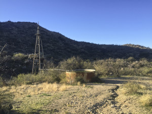
As I reached 5.62 miles on my Garmin I stood at 3,860 feet of elevation, having gained over 1.050 feet from the trailhead with some additional climbing thrown in to make up for some of the downhill sections. This was the point that Angela & I had previously come to when coming from the Honeybee side. There’s a water tank here with a dilapidated windmill and this is the end of the Wild Burro Trail, although the newly completed Ridgeline Trail does loop back towards the trailhead for those that want a return via a different route. That is another trail I want to explore another day. Today though I was about to head up the jeep road trail over the Tortolita Traverse Trail. This next section was the last hard climb of the day. It was all jeep road for about 0.75 miles as I gained close to another 300 feet of elevation, topping out at 4.150.
Elevated view looking back down towards the trailhead.
Finally at the peak of the run I knew the rest would be relatively easy, although I ended up walking some sections of the trail as my left knee in particular flared up with some pain. I’ve found that walking breaks does allow the pain to subside and I can run at least 1 mile segments at a time. I threw down a couple of 8:46 and 8:38 splits here for miles 8 & 9 as I enjoyed the gently sloping downhill single track. The remainder of the run grew tiresome dealing with my knees and my shortage of water, which I rationed reasonably well until finishing it off about 1.5 miles from the end of the run. I severely misjudged that aspect of this training run which I was bummed about. However, the day was a success overall.
The water tank at the far Wild Burro and Ridgeline Trail junction.
I rolled into the Sun City parking lot exactly at the same time Angela drove in with the kids. That was perfect timing! I felt great for having accomplished my first Tortolita Traverse and I do plan to repeat this again in the near future. I’d like to add onto this run and head all the way down to Catalina State Park one day. Another variation I’d like to perform is yo-yo’ing back from Sun City to the Wild Burro Trailhead again which would cover some 30 miles with quite a descent amount of ascent. Those will be a couple of fun runs that I’ll explore soon with Angela. For now it’s time to shut down most of the hard training until Antelope Canyon next week!